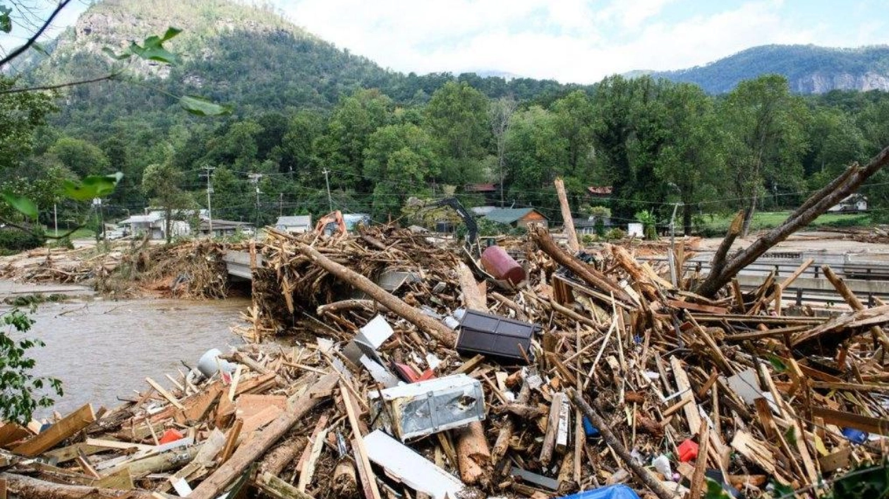
A combination of climate, geologic, and geographic factors has made Hurricane Helene one of the most destructive storms to ever strike the United States. Even days after it made landfall in Florida’s Big Bend region on September 26 and traveled hundreds of kilometers inland, Helene’s devastating effects continue to escalate.
Powered by the warm waters of the Gulf of Mexico, which climate change has made significantly more probable, the storm rapidly intensified offshore. By the time Helene hit land as a Category 4 storm, its wind speeds had exceeded 209 kilometers per hour (130 miles per hour). The powerful winds pushed the sea onto the shore, causing record-breaking floods that submerged coastal communities in meters of seawater. Near Keaton Beach, Fla., the storm surge was estimated to have reached at least 4.5 meters (15 feet) high.
Preliminary modeling of the storm surge from Hurricane Helene indicates that areas within the Big Bend region of Florida, near Keaton Beach, Steinhatchee, and Horseshoe Beach, experienced water levels more than 15 feet above ground level. This was just the beginning. After making landfall, Helene moved north through Georgia, delivering a record-breaking 28 centimeters (11 inches) of rain to Atlanta in 48 hours, surpassing the previous record of 24 centimeters (9.6 inches) set in 1886. As Helene entered the Appalachian Mountains, its rainfall triggered widespread flooding and fast-moving landslides known as debris flows, deadly mixtures of water, soil, and rock that can surge downhill for kilometers.
The mountainous western parts of North Carolina were particularly hard-hit, with some locations like Jeter Mountain and Busick reporting over 76 centimeters (30 inches) of rainfall. Washed-out roads and downed power lines caused outages that isolated the city of Asheville, home to nearly 100,000 residents. As of October 1, the death toll from Hurricane Helene has surpassed 130 people across six states, with the figure expected to rise as hundreds are still reported missing. The associated economic damages are estimated to be around $150 billion.
To understand how Helene left such a devastating trail of destruction, Science News spoke with four experts. Charles Konrad, a climatologist at the University of North Carolina at Chapel Hill, and coastal oceanographer Rick Luettich and aquatic ecologist Hans Paerl, both from UNC’s Morehead City campus, provided insights. Geologist Brad Johnson of Davidson College in North Carolina, who studies landslides, erosion, and the evolution of the Southeastern United States’ landscape, also contributed.
Luettich explained that Helene’s large size allowed it to push a significant amount of water. Tropical storm force winds extended over 480 kilometers (300 miles) from its center. Models predicted that barrier islands from Estero Island south of Fort Myers to Tampa Bay would go underwater, which was largely accurate. The warm waters of the Gulf of Mexico, combined with the wide and shallow west Florida shelf, contributed to the rapid intensification of the storm.
Paerl highlighted the risks of contaminants in floodwaters, including those from gas stations, wastewater treatment plants, and agricultural runoff, which can lead to harmful algal blooms. Konrad discussed the predecessor event in the Appalachian Mountains, where significant rainfall saturated soils and streams, making them more susceptible to flooding and landslides. Johnson emphasized that the peak risk of landslides and debris flows occurs during the precipitation event, but other hazards, such as downed power lines and flooded valley bottoms, remain.


