If you’ve ever seen photos of soaring skyscrapers surrounded by golden desert and turquoise sea, chances are you’ve seen Dubai. But where exactly is it? People often think Dubai is its own country, but it’s actually part of the United Arab Emirates, a federation of seven emirates on the southeastern edge of the Arabian Peninsula. Dubai sits right on the Gulf, roughly between Saudi Arabia and Oman, and over the years it’s gone from a quiet fishing port to a global icon of modern life. It’s the kind of place that blends sand dunes with shopping malls, and tradition with futuristic ambition, which might be why everyone keeps asking about it.
First Things First: Is Dubai A Country?
No. Dubai is not a country. It is both a city and an emirate that together form part of the United Arab Emirates, a federation of seven emirates. Think of an emirate as a territory with its own ruler that participates in a federal system. The seven emirates are Abu Dhabi, Dubai, Sharjah, Ajman, Umm Al Quwain, Ras Al Khaimah, and Fujairah.
The UAE is the country. Abu Dhabi is the national capital. Dubai is the most internationally famous city inside the country, which is why people sometimes confuse the brand with the nation.
Read more: Where Is Dubai and Why Everyone’s Talking About It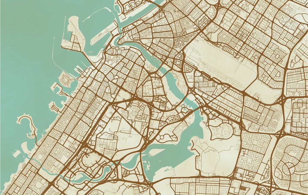
Where Exactly Is Dubai On The World Map?
Dubai sits on the southeastern edge of the Arabian Peninsula, along the Gulf. If you trace the curved coastline that sweeps from Kuwait down past Saudi Arabia and then east toward Oman, Dubai is on that inner gulf shoreline, partway down the coast. It is positioned in a way that places it within a few hours of flight time from Europe, Africa, South Asia, and much of the Middle East. That central geography is a big reason why it became a global hub for aviation and trade.
If you want a simple visual trick: picture a globe and find the narrow stretch of sea between the Arabian Peninsula and Iran. Follow the southern coastline of that gulf and you will land on Dubai.

Dubai Is More Than a Location: Our Take at World-Arabia
At World-Arabia, we like to think of Dubai as more than a point on the map. It’s a living, breathing mosaic of cultures, ambitions, and everyday moments that make this city unlike anywhere else. Our magazine was created to capture that energy – the people, the fashion, the design, the rhythm of life that defines the UAE’s most talked-about city.
Through our stories, we show how geography and lifestyle connect here. Downtown Dubai isn’t just a cluster of towers; it’s where creativity and commerce meet. Palm Jumeirah represents more than a man-made island; it’s a symbol of what’s possible when innovation meets vision. From art exhibitions and local designers to wellness trends and emerging entrepreneurs, we explore the many sides of this city that keep it moving forward.
So when you’re looking at Dubai on a map, remember – for us, it’s not just a location. It’s a story unfolding every day, and we’re here to tell it.
The Country Context: How Dubai Fits Inside The UAE
Inside the UAE, the Emirate of Dubai occupies a coastal slice between the Emirate of Abu Dhabi to the south and southwest, and the Emirate of Sharjah to the east and north. The city itself is the largest urban area within the Emirate of Dubai and stretches along the coast, spreading inland in corridors that follow major roads such as Sheikh Zayed Road.
A few useful points to keep your mental map tidy:
- Abu Dhabi city lies to the southwest of Dubai city, roughly a 1.5 to 2 hour drive depending on traffic.
- Sharjah city borders Dubai to the northeast. In practice, the two urban areas blend, and commuters cross that boundary daily.
- Inland, the terrain transitions from developed suburbs to desert. To the east, the mountains begin as you approach the borders with Oman.
The Gulf Coastline And Why It Matters
Dubai’s modern story is tied to its coastline. The Gulf gives the city:
- Deep water access for ports and trade
- Breezy waterfront districts that draw residents and visitors
- Space for ambitious projects like Palm Jumeirah and The World islands
Long before skyscrapers and malls, coastal access mattered for pearl diving, fishing, and commerce along Dubai Creek. That creek still runs into the heart of the city and splits older districts from what people often call “new Dubai.”
Not The Capital, But A Major Capital Of Something Else
Abu Dhabi is the capital of the UAE. That is where you find federal government institutions. Dubai, on the other hand, is the country’s best known commercial and tourism center. If Abu Dhabi is the national political seat, Dubai is the city that shows up in the lifestyle pages and business headlines. The roles complement each other.
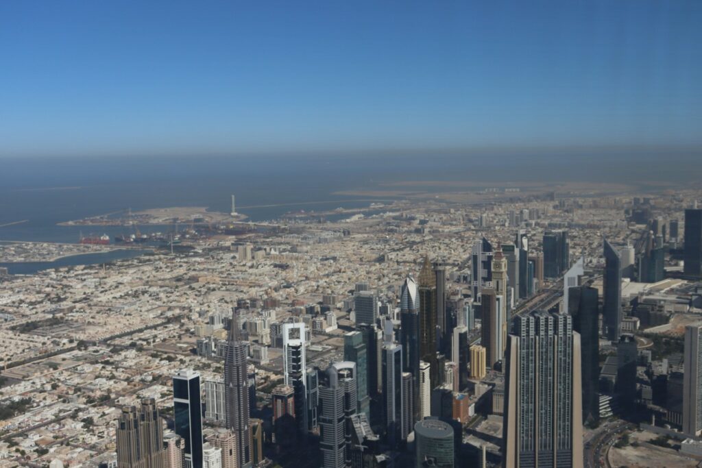
The Internal Map: Where Is Downtown Dubai, And How Does The City Layout Work?
Let’s switch from the globe to the street view. The city spreads along the coast and inland in a series of recognizable districts. Here is a practical way to think about its layout from northeast to southwest.
Old Dubai Around The Creek
This is where the city’s story began. Deira sits on one side of Dubai Creek, and Bur Dubai sits on the other. Souks, historic neighborhoods like Al Fahidi, museums, and traditional abra boats give this area a sense of place that is very different from the glass towers you see in the postcards. If you want Emirati history, this is your anchor.
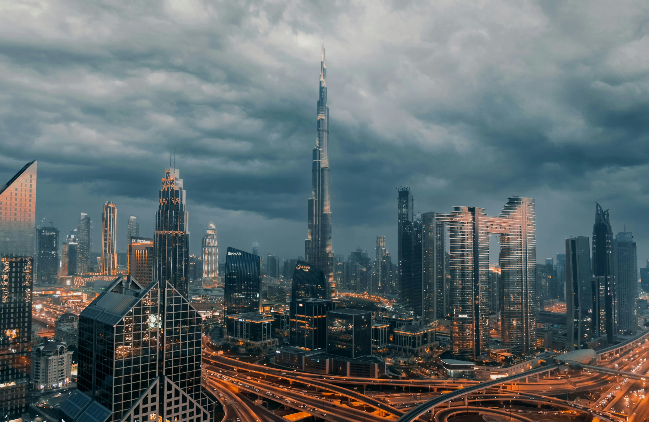
Downtown Dubai
Move southwest along Sheikh Zayed Road and you hit Downtown Dubai, the area anchored by Burj Khalifa and The Dubai Mall. It is central, modern, and well connected. When you see videos of fountain shows or time lapses shot from ultra tall buildings, you are looking at Downtown.
Business Bay and DIFC
Just around the corner from Downtown, Business Bay mixes offices and high rises, while DIFC hosts financial firms and a polished dining scene. Together, these form a work and play corridor that many visitors explore without realizing they are stepping across district lines.
Jumeirah and Umm Suqeim
Follow the coast and you reach low rise residential areas, beaches, and landmarks like the sail shaped Burj Al Arab. This stretch gives you open water views, family friendly hotels, and sunset walks.
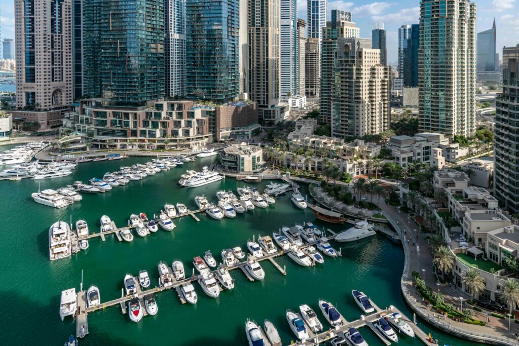
Dubai Marina and JBR
Further southwest sits Dubai Marina with its canal, yacht berths, and tower lined skyline. Next door, Jumeirah Beach Residence brings beach life, public walkways, and a lively dining scene. This area is one of the easiest for first timers to picture because it looks exactly like the name suggests: a marina beside a beach neighborhood.
Palm Jumeirah
Offshore from the Marina and JBR is Palm Jumeirah, an engineered island shaped like a palm tree. It is home to resorts, residences, and one of the city’s most famous hotels. It is also a convenient compass point. If you see photos of a crescent shaped breakwater wrapping an island with fronds, you are looking at the Palm.
Jebel Ali and Dubai South
Keep going and you reach Jebel Ali Port and free zone, then on to Dubai South where Al Maktoum International Airport is expanding. This is the industrial and logistics engine room, and it ties the city to shipping lanes and cargo networks.
How To Pin Yourself On The City Map Without Getting Lost
Most people navigate Dubai with a small set of anchors and routes. Here is a simple approach you can use on your first day.
- Pick two lines: Sheikh Zayed Road for the inland spine, the coastline for your seaward edge. These run roughly parallel for long stretches.
- Mark three anchors: Burj Khalifa for Downtown, Dubai Marina’s canal towers at the southwest end, and Dubai Creek in the northeast.
- Map one or two connectors: the Metro Red Line roughly follows Sheikh Zayed Road and links the airport, Downtown, Marina, and beyond. If you can find a Metro station sign, you can usually find your way back to a landmark.
When you layer these three ideas together, the sprawling city snaps into a few manageable shapes.
Getting There: Airports, Land Routes, And The Practical Stuff
By Air
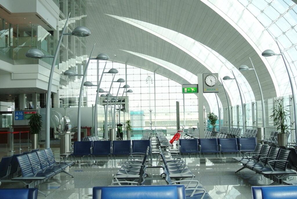
Dubai International Airport (DXB) is one of the busiest airports in the world. It sits on the Deira side of the city near the Creek. Many long haul flights land here. Al Maktoum International Airport (DWC) sits further southwest near Dubai South and is growing its schedule. For most travelers today, DXB remains the default.
By Road
If you are coming from Abu Dhabi, you will almost certainly drive the E11, also known as Sheikh Zayed Road, which connects the cities in a straight line. From Oman, routes converge on border posts that feed into Dubai through the inland desert or the east coast, depending on your start point.
Moving Around Once You Arrive
- The Metro Red Line is the simplest way to hit the main tourism spine, from the airport to Downtown to the Marina.
- Taxis and ride hailing are widely used and straightforward.
- Buses, trams in the Marina area, and abras across the Creek round out the network.
What Dubai’s Geography Tells You About The Experience On The Ground
Two things shape what you will feel when you step into the city: the desert and the sea. The desert explains the bright light, the way neighborhoods are planned around shade and water, and why evenings are so social. The sea explains the focus on waterfront living and the way the city reaches out with marinas, islands, and long promenades.
This pairing also explains the city’s famous contrast. You can ride a boat on the Creek in the morning, shop in a cool mall at midday, walk a beach at sunset, and eat in a neighborhood that looks like it belongs in a design magazine by night.
Neighborhood Snapshots You Can Actually Use
If you only have a few days and want to choose where to base yourself, this practical breakdown will help you match your plans to the right part of the city.
1. Downtown Dubai
Downtown Dubai is ideal for first time visitors. It puts you within walking distance of Burj Khalifa and The Dubai Mall, and transportation is simple because the Metro and main roads run right through the area. Everything feels concentrated, making it easy to navigate without covering long distances.
2. Dubai Marina and JBR
Dubai Marina and JBR suit travelers who want water views, beach time, and an active social scene. The area is built around promenades, restaurants, and boat tours, so there is always something happening. Getting to Downtown takes a bit longer, but the Metro line and taxis connect the districts cleanly, which keeps the commute manageable.
3. Palm Jumeirah
Palm Jumeirah offers a quieter, more resort oriented experience. It is a good fit for families and couples who prefer a calm base with plenty of space. Movement here relies mostly on taxis or ride hailing rather than public transport, and that slower, more private rhythm is part of the charm.
4. Old Dubai Around the Creek
Old Dubai is perfect for travelers interested in history, culture, and the city’s roots. Staying around the Creek gives you access to museums, traditional markets, abra crossings, and heritage hotels. The pace is gentler, and the area maintains a strong sense of identity compared to the newer districts.
5. Jumeirah and Umm Suqeim
Jumeirah and Umm Suqeim blend residential calm with beachfront living. These neighborhoods have long beaches, villas, and iconic views like the Burj Al Arab. They work well for people who want a relaxed local vibe with easy beach access and a more laid back pace than the busier city center.
How Geography Shaped Dubai’s Rise
A city does not grow by accident. Dubai’s location gave it several useful advantages. It sits at a midway point between Europe, Africa, and Asia, which naturally makes it an aviation and logistics hub. Its deep coastline and historic creek supported trade long before skyscrapers took over the skyline, allowing merchants to connect with routes that linked the Gulf to India and East Africa. The space along its coast and inland corridors made it possible to plan neighborhoods and build the infrastructure that fuels its expansion today. When you combine those geographic advantages with decades of investment in airports, ports, roads, tourism, and services, you get the modern city most people recognize now, a place that turned geography into opportunity.
Reading The Map Like A Local
Locals often navigate Dubai using just a few key reference points rather than a full map, and you can do the same. Sheikh Zayed Road is the city’s main spine – if you’re on it, you can reach almost anywhere. Burj Khalifa serves as your north star; if you can see it, you know where Downtown is. The coastline runs like a thread of pearls, and if the sea is on your right while you head southwest from the Creek, you’re moving through Jumeirah, then the Marina, and finally Jebel Ali. Even the Metro stations mirror major landmarks and districts, so reading their names is like reading a summary of the city itself.
Useful Lists For Fast Planning
Key Districts In One List
- Old Dubai: Deira and Bur Dubai around the Creek
- Downtown Dubai: Burj Khalifa, Dubai Fountain, Dubai Mall
- Business Bay and DIFC: offices, galleries, dining
- Jumeirah and Umm Suqeim: beaches and villas
- Dubai Marina and JBR: canal skyline and beach promenade
- Palm Jumeirah: resort island
- Jebel Ali and Dubai South: ports, free zones, and the second airport
Orientation Anchors You Can Spot From Photos
- Burj Khalifa: Downtown center
- Burj Al Arab: Jumeirah coast
- Ain Dubai observation wheel: Bluewaters near JBR
- Atlantis on the Palm: outer edge of Palm Jumeirah
- The Dubai Frame: gateway object near Zabeel between old and new districts
Simple Transport Rules Of Thumb
- Metro Red Line for the main tourism corridor
- Taxis and ride hailing for cross connections to beaches and islands
- Abras across the Creek for short, memorable hops between Deira and Bur Dubai
Conclusion: Understanding Dubai Beyond the Map
Knowing where Dubai is goes far beyond its coordinates on the Gulf. Yes, it’s a city in Asia, part of the United Arab Emirates, bordered by Saudi Arabia and Oman. But geography only explains part of the story. What makes Dubai remarkable is how it turned that stretch of coastline and desert into one of the world’s most recognizable urban skylines – a place that connects continents, cultures, and people.
When you picture it now, don’t just think of towers and malls. Think of a city that grew from trade routes and fishing boats into a modern hub that still carries traces of its past. Whether you explore the old markets by the Creek or the high-rise views from Downtown, you’re standing in a city built on movement, ambition, and contrast. That’s what makes Dubai more than just a dot on the map, it’s a story that keeps unfolding, one skyline, one idea, and one new visitor at a time.
Frequently Asked Questions
What continent is Dubai in?
Asia. More precisely, the Middle East on the Arabian Peninsula.
Is Dubai a capital?
Dubai is the capital of the Emirate of Dubai, but the national capital of the UAE is Abu Dhabi.
Which emirates border Dubai?
Abu Dhabi to the south and southwest, Sharjah to the north and east.
How far is Abu Dhabi from Dubai by car?
Roughly 140 km, often 1.5 to 2 hours depending on traffic.
Where is Downtown Dubai within the city?
Just south of Dubai Creek and east of Sheikh Zayed Road’s central stretch, anchored by Burj Khalifa.